CHRIS WOOD: NATURAL SECURITY
Published April 8, 2014
The 1,000-gun salute in the realm of natural security these past weeks has been for the Fifth Intergovernmental Panel on Climate Change Report. So let me talk (mostly) about something else instead.
The IPCC’s latest synthesis of science mainly confirms widely known trends and risks and warns, yet again, that our business-as-usual is leading us to the extreme end of the range of climate forecasts by the end of this century.
So instead of dwelling on that, let me take you to one specific place where the climate hasn’t waited for the end of the century. We know this because of some new, first-hand science that was released at about the same time as the IPCC’s oxygen-sucking volume. The place is a critical conduit and bi-modal influence in the Rube Goldberg machine of global climate—connected through as-yet unmapped downstream linkages to ocean currents literally on the far side of the planet.
That place is the Mackenzie River delta on the Arctic Ocean’s Beaufort Sea. Here is where one page of the IPCC’s executive summary for policy-makers (the Cole’s notes version that you really hope your representative might actually glance at) is relevant. Consider two images from it, reproduced below.

The sea ice image shows our world, viewed from above the North Pole instead of in the deeply misleading but familiar Mercator projection. See all the expanse of white on the Arctic Ocean on the right? Exactly. That’s how much summer ice will be left by the 2081-2100 period on our current emissions track.
But that’s an aside. Note now that the Arctic Ocean — the new last frontier for avaricious extraction industries and politicians in search of a legacy — is essentially divided between two coastlines. One is mostly Russia. The other is mostly Canada, bracketed by bits of America and, technically, Denmark.
Feeding that ocean are a few very large rivers. On Russia’s side the Lena, Yenisey and Ob are the largest. Along the Arctic’s western hemisphere shoreline, there is only one river in the same league: Canada’s Mackenzie.
Now turn your attention to another image.

The inferno tones of the world map on the right estimate how much average temperatures around the world will rise by the same 2081-2100 period. This is our future, as we are currently going (in contrast to the future we might experience if we took immediate action to reduce carbon emissions now, a vanishing dream-state represented on the left).
Up toward the upper left in that map, far west and north of Hudson Bay and east of the bulge of Alaska’s north slope, is where the Mackenzie’s flow of fresh water, collected over an expanse the size of western Europe, enters the ocean. Here, the IPCC forecasts that temperatures in the last two decades of the present century will be 5-6o Celsius warmer than in the decades from 1986-2005.
That degree of heating is staggering, not least for ecosystems adapted to change on the scale of millennia, not decades. It’s the kind of transformation that inspires the energing genre of climageddon porn and despairing speculation about the end of civilization from such well-informed observers as George Monbiot. 5-6oC by the end of the 21st century would be… catastrophic.
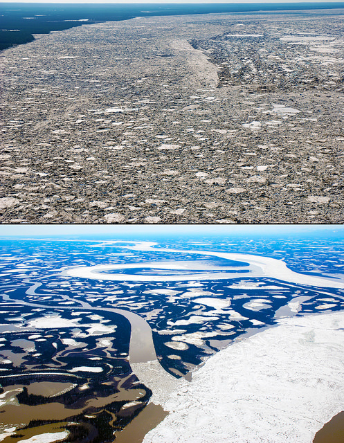
Except that the map is wrong. The vast, lake-studded river delta that is the northern nursery for millions of migratory birds and the primary source of biological nutrients to the Beaufort Sea, is not going to have warmed by 5-6oC by the end of the century. It already has.
This fact appears in a paper in Geophysical Research Letters by a team of Canadian researchers. As seems to happen often in science, they were looking for something else: an explanation for why the winter ice that annually covers the Mackenzie River has been breaking up earlier, on average, every year.
Common sense suggested it had something to do with the generally rising temperatures in the north polar region, where (the IPCC’s certainly right about this) the planet is warming faster than anywhere else. But the scientists weren’t sure what the mechanism really was. So they compared air temperature, water flow and ice-movement data from various records up and down and in the middle of the Mackenzie delta going back to the middle of the last century.
That’s when they discovered that mean winter temperatures in the middle of the Mackenzie River Delta have already risen by 5.3o C in the time since 1957. Climageddon, or at least its imagined thermal trigger, had aready arrived.
Here the story takes an unexpected twist: it wasn’t that giant leap for man-made temperatures that was actually driving the early break-up of Mackenzie River Delta ice at all. It was a much smaller (if still large, by experience elsewhere) increase of just 3.6oC in mean air temperatures during the spring break-up season, and… here something like a drum-roll is appropriate … a no-less staggering drop of about a third in the amount of winter snow falling on the frozen river to insulate its ice.
None of this has so far set off catastrophe, economic or ecological. That’s the happy news. The less-happy of course is that the clock has just started to run on this grand, real-time experiment in Canada’s natural security and the world’s climate stability. Further south in the Mackenzie watershed, rising temperatures have indeed already meant catastrophe, of a sort, for ecological communities built on black spruce forests, as these collapse into ponds formed from permafrost now defrosted.
Now, among the stronger implications of the Canadians’ science is that the Mackenzie aluvial fan faces a great desiccation of the kind that devastated the vast inland delta — a global rarity — upstream at the confluence of the Peace and Athabasca Rivers, in the late 1960s, after British Columbia built one of the world’s largest hydro dams on the first of those. While the reservoir behind the Williston Dam filled, little water flowed down the Peace; its natural flow cycle remains distrupted to this day. Wildlife populations from ducks to beaver collapsed. Climate change now points to the same fate for the larger and more vital Mackenzie Delta. Declining winter snowfall, with earlier breakups, means that spring releases less fresh water to flood its marshes and replenish its tens of thousands of lakes and ponds.

The implications don’t end when the Mackenzie’s rich grey streams empty through a score of channels over a 300-km coastline into the Beaufort Sea. There, they constitute the largest single flow of nutrients into the western half of the polar basin — a foundation for the food chain that would support any future Arctic fishery to feed a hungry world.
The Mackenzie’s enormous volumes of fresh water also contribute to the wobbly jostling act of undersea currents and pools of differing temperatures, densities and salinities of seawater, whose perpetual push and pull drives the planet’s biggest heat-transport device: a submerged current that loops continously at various depths beneath the ocean surface from the south Pacific off Australia to the Labrador Straight between Greenland and Canada and back. The current’s linkages to the Arctic Ocean remain a mystery — as does how changing that ocean’s fresh/salt water balance may affect the rest of the world’s local weather patterns.
Which is to leave you with two thoughts. First: the future is arriving ahead of schedule. And two: we have only the vaguest idea how it works.
And if ‘catastrophic’ warming hasn’t unleashed wholesale transformation on the Mackenzie River yet, we may have only to wait. The Simon Fraser University geographer who led the Mackenzie ice team has worked on the river a long time. “The system just looks like it’s perched, ready to change,” Lance Lesack told me when we spoke about his work. “I don’t think the effect is going to be small.”
It probably won’t wait for 2081 either.
Copyright © 2014 Chris Wood
Contact: cwood@canadianjournalist.ca
Further reading:
F&O brief on the IPCC report, with links: Food, water, health, livelihoods already hit by climate change
SPREAD THE WORD: To tell others about this column, please “share” the Frontlines notice.
Independent, non-partisan and employee-owned, F&O performs journalism for citizens, funded entirely by readers who buy a subscription or a $1 site day pass. We do not carry advertising or solicit donations from non-journalism foundations or causes. Sign up here for email notices of new work with the subscribe form on Frontlines, where we also post small stories.